What makes a hill different from a mountain? Why is a bay not the same as a gulf? How can a piece of land be almost surrounded by water and still be attached to the mainland? These are the questions curious children ask when they first discover the fascinating world of inland and coastal features.
What Are Inland and Coastal Features?
Let us start with a simple idea. Every landscape on Earth has two parts: the land away from the water and the land where it meets the water.
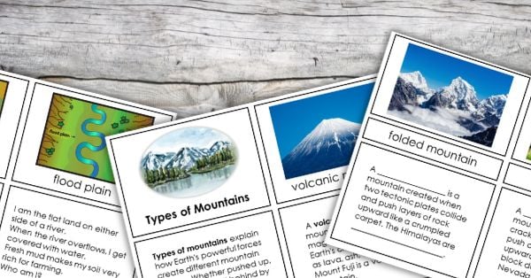
Inland features live far from the coast. They include mountains, valleys, plateaus, canyons, caves, hills, plains, craters, swamps, lakes, rivers, waterfalls, oases, and sources of rivers. These features shape the inside of continents.
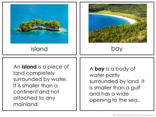
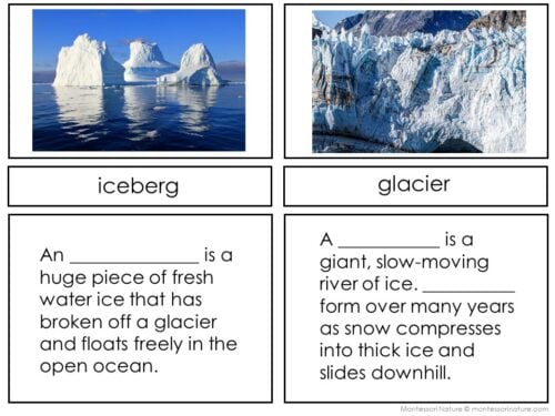
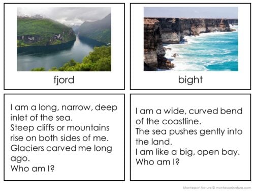
Coastal features live where land touches the ocean or sea. They include peninsulas, capes, bays, gulfs, isthmuses, straits, archipelagos, lagoons, cliffs, harbors, fjords, bights, reefs, estuaries, beaches, coves, points, icebergs, and glaciers. These features shape the edges of the land.
When children learn to tell these features apart, something wonderful happens. They stop seeing a blur of land and water. Instead, they see a world made of recognizable shapes with names and stories.
Here is the truth. Children love learning big, important words. Give a child the word “isthmus,” and they will never forget that a narrow strip of land connecting two larger landmasses has a special name. Give them “fjord,” and they will picture steep cliffs plunging into deep, cold water.
These words are not hard for children. They are exciting. Every new term unlocks another part of the map. Children become experts. They point at pictures and say, “That is not just a beach. That is a cove.” They feel smart because they are smart.
How Inland and Coastal Features Fit Into the Imaginary Island Project
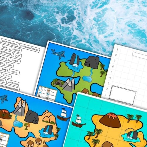
The Montessori Imaginary Island project is a beloved geography work where children build their own island from clay or salt dough, then draw a topographic map of it. But before a child can build and map their island, they need to know what to build.
That is where learning inland and coastal features comes first.
A child who knows what a peninsula is can decide to add one to their island. A child who understands the difference between a bay and a gulf can choose which one to carve into their coast. A child who has learned about mountains, rivers, and lakes can place them thoughtfully across their island.
The features are the building blocks. The Imaginary Island is what children create with them.
Hands-On Science Activities for Exploring Inland and Coastal Features
Here are five hands-on science activities that let children explore these features directly.
Activity 1: Build a Peninsula in a Pan
What you need: A shallow baking pan, sand or clay, water, a small pitcher
What to do: Fill the pan with a layer of sand or clay. Shape one side into a large landmass. Then push a long finger of land out into the empty side of the pan. Slowly pour water into the empty side until it surrounds three sides of your finger of land. You have just made a peninsula.
What children learn: A peninsula is land surrounded by water on three sides. They can see it. They can touch it. They will never confuse it with an island again.
Activity 2: Carve a Canyon with Water
What you need: A deep tray, sand or dirt, a spray bottle or small watering can with a narrow spout
What to do: Fill the tray with packed sand or dirt. Build a raised plateau at one end. Now spray or pour a steady stream of water at the top of the plateau. Watch as the water cuts a narrow, steep-sided channel through the sand. That channel is a canyon.
What children learn: Canyons are not just holes in the ground. They are carved by water over time. This activity shows the process in minutes instead of millions of years.
Activity 3: Create a Strait Between Two Landmasses
What you need: Two lumps of clay, a large baking pan, water
What to do: Place the two clay lumps in the pan, a few inches apart. Pour water around them until the water fills the space between. The narrow passage of water connecting the larger body on both sides is a strait.
What children learn: A strait connects two larger bodies of water. If you remove one clay lump, the passage becomes something else. The position matters.
Activity 4: Make an Archipelago in a Bowl
What you need: A large bowl, water, several small rocks or clay balls
What to do: Fill the bowl with water. Place the small rocks or clay balls in the water, scattered apart from each other. None of them touch. Each rock is an island. Together, they form an archipelago.
What children learn: An archipelago is not one island. It is a group or chain of islands. The Hawaiian islands are an archipelago. So are the thousands of islands in Indonesia.
Activity 5: Watch a Glacier Carve a Fjord
What you need: A block of ice, a tray of packed sand or clay, a small weight (like a metal washer) frozen into the ice
What to do: Place the ice block at the top of the sand tray. Let it sit as it melts. Gently pull the ice block straight down the tray. The ice will scrape a deep, U-shaped channel. If you pour water into that channel, you will see a fjord shape.
What children learn: Fjords are not regular valleys. They are carved by moving glaciers. That is why they are steep and deep.
Later, when they start the Imaginary Island project, those experiences come back. A child who carved a canyon with a watering can will know exactly where to place a canyon on their clay island. A child who made an archipelago in a bowl will want to scatter islands off their coast.
Start with the Features, Then Build the Island
If you are planning an Imaginary Island project, begin here. Let children explore inland and coastal features through hands-on science first. Give them picture cards and definition cards so they learn the names. Let them pour water, shape clay, and watch how land and water interact.
Then, when they finally pick up the salt dough to build their own island, they will not be guessing. They will be drawing on real knowledge they discovered themselves. That is the kind of learning that lasts.
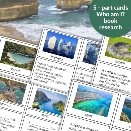
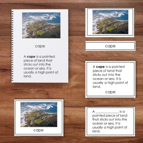


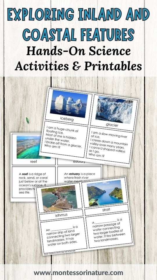
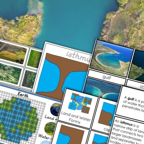
Inland and Coastal Features
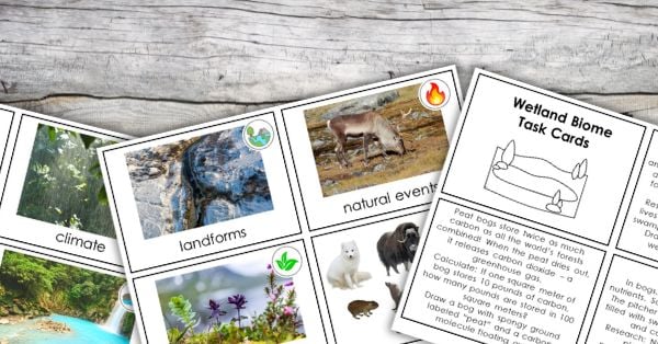
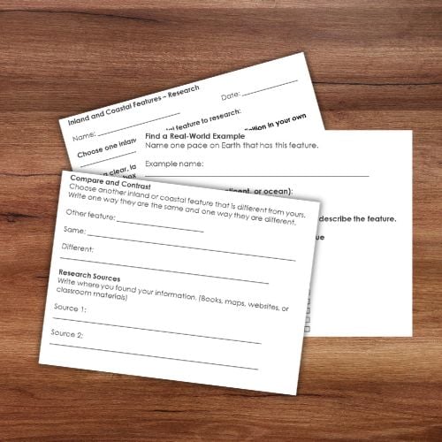
This Land and Water Forms resource supports the Montessori Imaginary Island project. It introduces 39 inland and coastal features through 5‑part cards, a book, riddles, and a research worksheet. Before children can map their Imaginary Island, they need to know what they are drawing. Is that a peninsula or a cape? A bay or a gulf? A strait or an isthmus? This resource gives them the answers.
This printable is also available on TPT
You Might Also Enjoy
About Anastasia | Anastasia is a certified early childhood teacher with over twenty years of experience in Montessori classrooms and homeschooling. As the founder of Montessori Nature, she creates evidence-based, nature-inspired educational printables. Discover more resources on her blog and Teachers Pay Teachers store.