Have you ever watched a child shape a lump of clay into a mountain and proudly announce, “This is a volcano”? Or seen them carve a winding river with their finger and ask, “Why does the river bend like that?”
If so, you already know: children are natural geographers. They just need the right words and a few hands‑on experiences to turn their curiosity into real knowledge.
Today, let’s talk about types of mountains and river landforms.
Why Teach Mountains and River Landforms Together?
Mountains and rivers are deeply connected. Mountains are where many rivers begin. Rivers then carve valleys, create flood plains, form meanders, and build deltas. When children learn both at once, they see the whole story of a landscape – from rugged peaks to winding rivers to the sea.
Hands‑On Science Activities for Mountains and Rivers
Before we look at any printable, let’s get our hands dirty. These activities use simple, inexpensive materials.
Activity 1: Make a Folded Mountain with Towels
What you need: 3‑4 flat hand towels or pieces of felt, a table.
What to do: Stack the towels flat on the table. Push the ends of the stack toward each other slowly. Watch the towels buckle and fold upward. You have just made a folded mountain.
What children learn: When tectonic plates collide, rock layers fold like towels. The Himalayas are folded mountains.
Activity 2: Build a Block Mountain (Fault‑Block) with Sponges
What you need: Two rectangular sponges, a tray.
What to do: Place the sponges side by side flat on the tray. Push the left sponge upward while keeping the right sponge still. The raised block is a block mountain (horst). The lowered area next to it is a valley (graben).
What children learn: Fault‑block mountains form when Earth’s crust breaks and blocks rise or fall. The Sierra Nevada range is an example.
Activity 3: Create a Meander and Oxbow Lake in a Pan
What you need: A shallow baking pan, sand, water, a pitcher.
What to do: Build a straight, narrow river channel in the sand. Gently pour water from the top. Over a few minutes, the water will naturally erode the outer banks and deposit sand on the inner banks, forming meanders. If you pour long enough, a meander neck may cut through, leaving a crescent‑shaped oxbow lake.
What children learn: Rivers don’t stay straight. They curve, and those curves can become cut‑off lakes.
Activity 4: Build a Delta in a Bowl
What you need: A large bowl, sand or fine dirt, water, a small spoon.
What to do: Fill the bowl halfway with water. At one edge, build a “river” of sand sloping down into the water. Slowly pour a thin stream of water down the sand. Watch as sand builds up at the bottom of the bowl, spreading into a fan shape – a delta.
What children learn: Deltas form when rivers slow down at their mouth and drop sediment. The Nile Delta is a famous example.
Activity 5: Model a Flood Plain
What you need: A shallow tray, clay or sand, water, small toy houses (optional).
What to do: Build a flat, wide valley with a small river channel through the middle. Place toy houses on the flat land. Pour water slowly into the river until it overflows its banks. The water spreads across the flat land – that is the flood plain.
What children learn: Flood plains are naturally flat areas where rivers spread during floods, depositing rich soil.
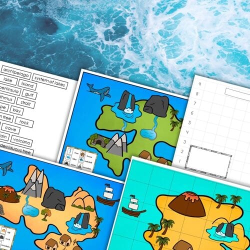
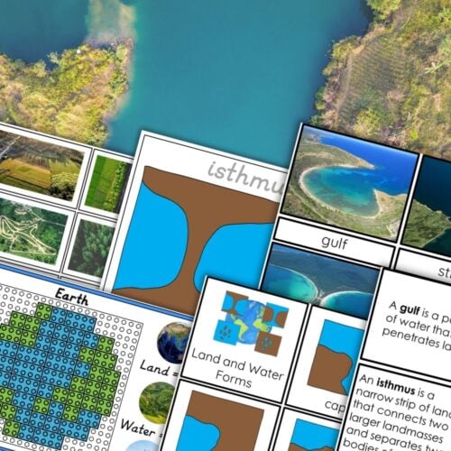
How the Printable Resource Helps (And Fits the Imaginary Island Project)
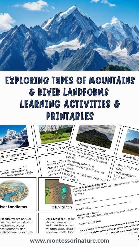
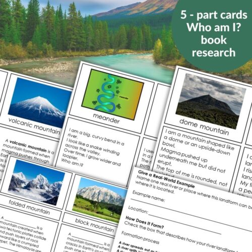
Now, let me share a resource that makes teaching these landforms so much easier. It’s a set of picture cards, definition cards, and research worksheets for Types of Mountains and River Landforms.
What’s inside?
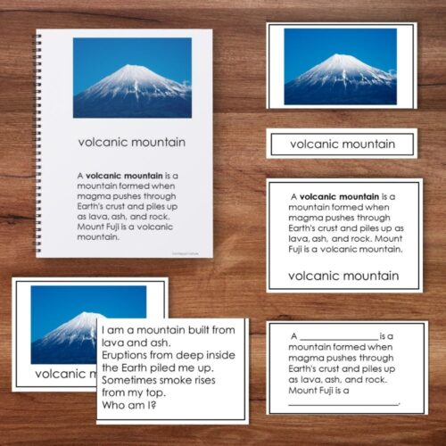
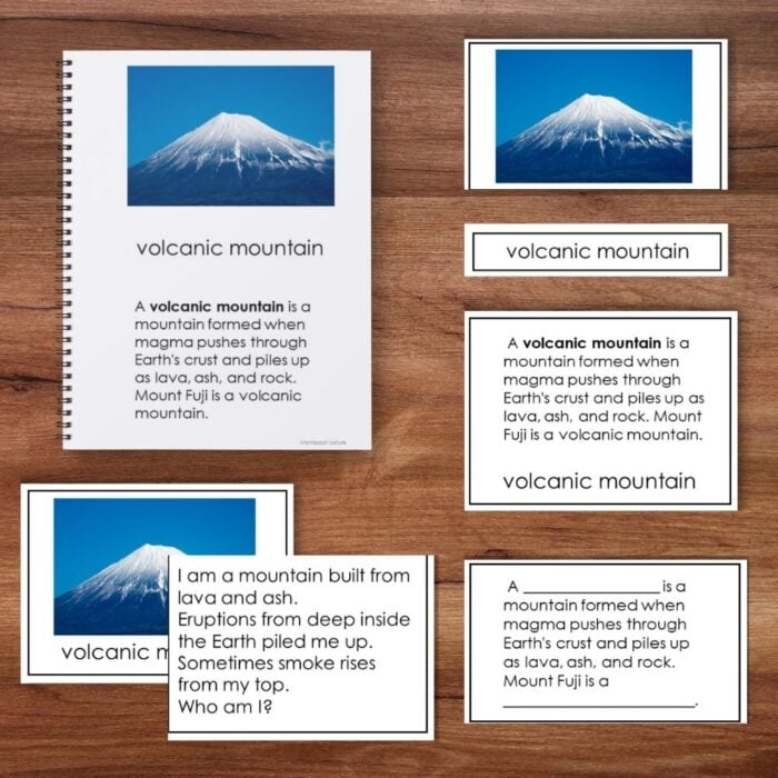
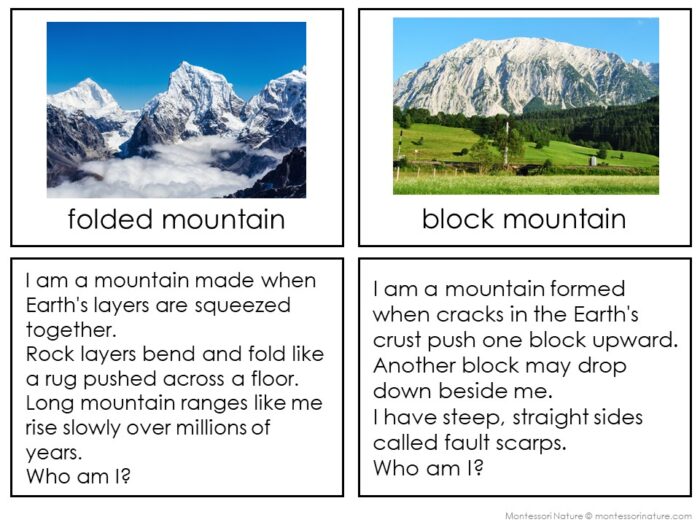
Mountains (6 types):
volcanic mountain, folded mountain, block mountain, dome mountain, plateau, residual mountain
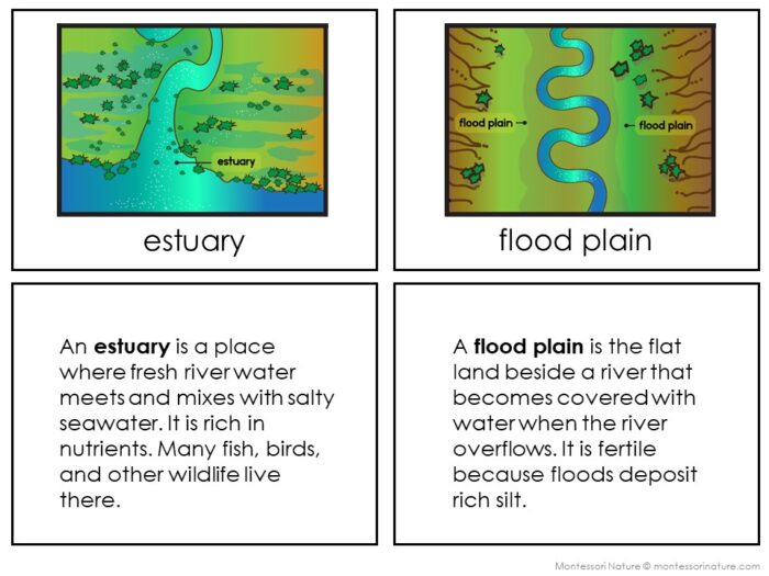
River landforms (9 features):
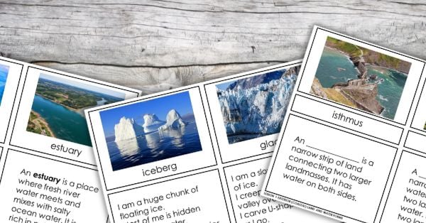
braided river, delta, estuary, flood plain, meander, oxbow lake, oxbow lake formation, river mouth, tributary
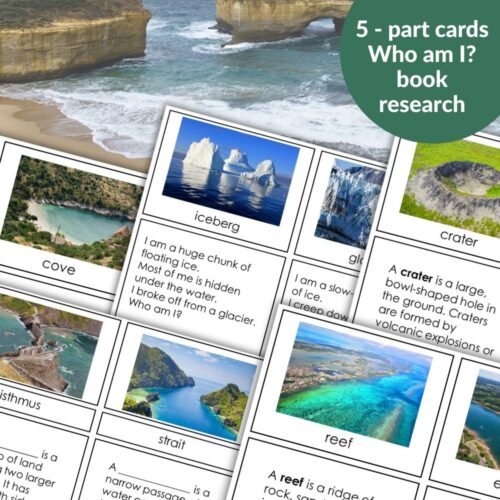
For each term you get:
Labeled picture card
Definition card
Cloze (fill‑in‑the‑blank) card – the same definition with the term missing (great for matching and self‑checking)
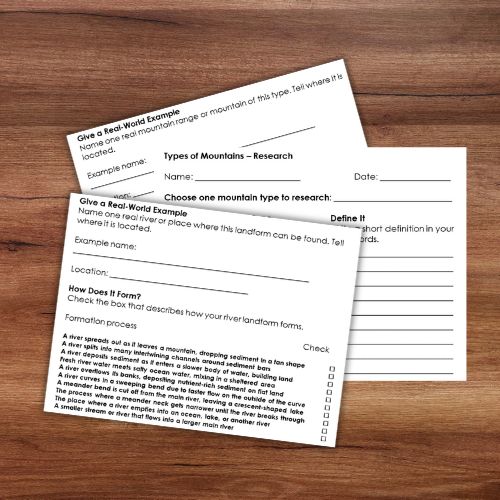
Plus two research worksheets (one for mountains, one for rivers) where a child can draw, define, give a real‑world example, write their own questions, and compare landforms.
How it guides the Imaginary Island project
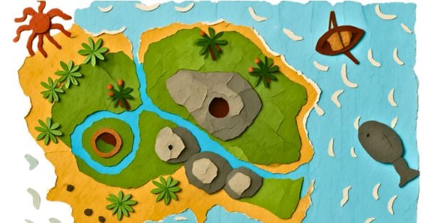
In the Montessori Imaginary Island project, children build an island from salt dough and then draw a topographic map. Without guidance, they might just make random bumps (mountains) and squiggly lines (rivers).
With these cards, they make informed choices.
A child studies the picture of folded mountains and decides to sculpt parallel ridges along the island’s center. Another learns about deltas and adds a fan‑shaped deposit at the river’s mouth. A third reads about meanders and carves sweeping bends into their river.
The cards answer the question: “What should I build?”
Using the Printables with Different Ages (6–9 vs. 9–12)
Ages 6–9 (Younger children)
Introduce 3–4 mountain types and 3–4 river landforms first.
Match picture cards to definition cards together.
Bind matched pairs into a small reference book with a metal ring.
For research, complete only the drawing, definition, and real‑world example.
During salt‑dough work: Ask them to add one mountain type and one river landform to their Imaginary Island.
Ages 9–12 (Older children)
Introduce all 6 mountain types and 9 river landforms at once.
Match independently; use cloze cards for self‑quizzing.
Sort mountains by formation (volcanic, folded, block, dome, residual) and note that a plateau is flat‑topped.
Sort river landforms by where they happen (upper, middle, lower course).
Complete full research worksheets, including writing two questions and comparing landforms.
During salt‑dough work: Add at least two mountain types and three river landforms. Write labels for each.
Mixed‑age classroom
Pair an older child with a younger child. Older reads definitions; younger finds the matching picture. Then switch roles.
So when they build their own Imaginary Island in salt dough, they’ll know exactly what kind of mountains to sculpt and how their river should flow.


Mountains and River Landforms
This Mountains and River Landforms resource supports the Montessori Imaginary Island project in both earth science and geography. It introduces 6 mountain types and 9 river landforms through 5‑part cards, a book, riddles, and student research worksheets.
This printable is also available on TPT
You Might Also Enjoy

About Anastasia | Anastasia is a certified early childhood teacher with over twenty years of experience in Montessori classrooms and homeschooling. As the founder of Montessori Nature, she creates evidence-based, nature-inspired educational printables. Discover more resources on her blog and Teachers Pay Teachers store.