Pin Flags Bundle
This Montessori bundle features maps of North America, South America, Africa, Europe, Asia, Oceania, and Antarctica, and is designed for the Montessori Cultural Area for Kindergarten through Grade 3. The set includes detailed color maps, blackline maps, and pin flags for each continent, offering a hands-on approach to learning about geographical locations and features. These materials work well for individual quiet shelf work, small group lessons, or centers, and they can be integrated into thematic units on world cultures and geography. The activities support geographical awareness, fine motor skills through map work, and familiarity with continents and countries, with options that suit various learning levels and classroom settings.
Pick exactly what you need from this bundle. The bundle discount is calculated automatically in your cart based on the total value of the items you select.
-

Antarctica Map and Cards
$3.50 Add to cartBring the icy landscapes of the southernmost continent into your classroom this winter with these Antarctica resources. This Antarctica Map printable is designed specifically for primary and elementary students. Helpful addition for the Antarctica Continent Box, this printable helps young explorers uncover the unique geographical features of Antarctica with hands-on activities.
-

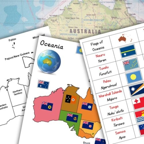
Oceania Maps and Pin Flags
$3.20 Add to cartOceania and Australia Maps and Flag Cards for Coloring, Labeling, and Geography Learning
Enhance your students’ geography skills and cultural awareness with this comprehensive printable resource featuring Oceania and Australia maps and flag cards! This versatile set is perfect for teachers of various age groups and can be used in a range of educational contexts. -
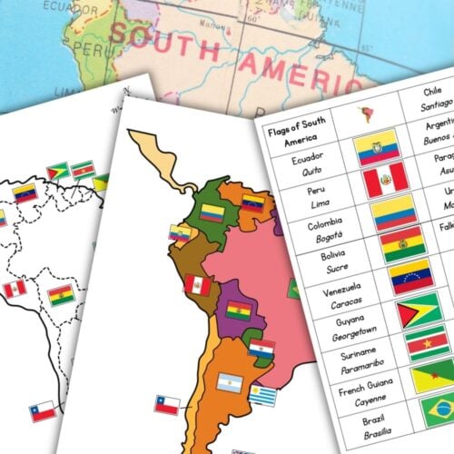
South America Map Pin Flags
$3.00 Add to cartSouth America Maps and Flag Cards: A Comprehensive Resource for Geography and Social Studies
This comprehensive resource provides a variety of maps and flag cards to help your students learn about the continent of South America. The colored maps show country borders with and without labels, making it easy for students to identify and label the different countries. The outline maps provide a blank slate for students to practice their coloring and labeling skills. The flag cards include 14 different countries with corresponding labels and capital cities. -
Europe Map and Pin Flags
$3.00 Add to cartEurope Map Printables with Flags and Labels – Colorful Geography Resource
Take your students on a journey through Europe with this printable resource! This pack includes six maps of Europe that can be used in a variety of ways to help your students learn about the continent. -
Africa Map Pin Flags
$4.00 Add to cartAfrica Pin Flags and Maps for Geography and Cultural Education
Take your students on a journey across the continent with this comprehensive Africa Pin Flags and Maps resource! This printable bundle includes a range of colorful maps and card strips that can be used to teach children about the countries, cultures, and geography of Africa. -
Asia Map Pin Flags
$3.00 Add to cartAsia Map Printable: Colored and Black & White with Labels and Flags
Enhance your geography lessons with this comprehensive Asia map printable! This resource is ideal for teachers who want to make their geography lessons engaging, interactive, and fun! Download now and start exploring the wonders of Asia with your students! -
North America Map and Pin Flags
$3.50 Add to cartEnhance your geography lessons with these detailed and versatile North America maps! This printable resource includes 8 different maps that can be used with various age groups and in multiple contexts – for coloring, labeling, pinning flags, marking locations, etc.